Flooding prevented

Maidenhead.net - News - Flooding prevented

maidenhead.net

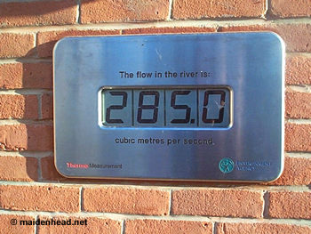
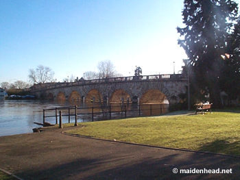
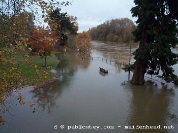
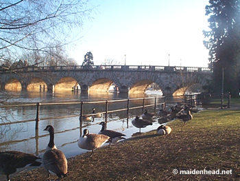
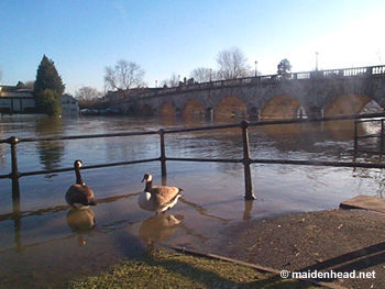
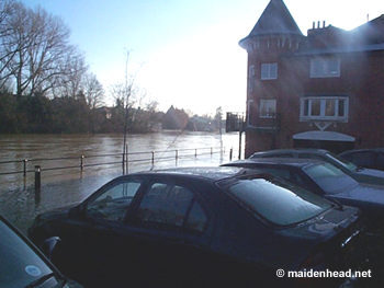
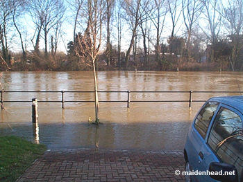
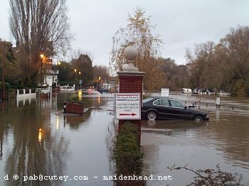
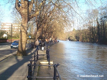
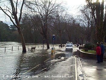
Jubilee River prevents major flooding in Maidenhead
Last updated 5 January 2003 at 23:30

Environment Agency status "Flood Warning"

It is believed that the Jubilee River, opened in 2002, has saved Maidenhead from its worst floods for years. Other local areas on the Thames (Cookham and Marlow) have been badly affected by flooding but Maidenhead has escaped with only minor flooding. The river's state has only affected one block of flats (which are the lowest point in the area).

These photographs were taken on Sunday afternoon, 5 January 2003, unless otherwise stated.

<<
Maidenhead bridge and the small gardens beside it. The seat shown on the grass is the same one...
>>
...as in this shot in November 2000 (the last major flooding). As you can see the flooding then was much worse.
<<
Another shot of the river and railings
<<
Nice weather for geese...
<<
These flats on Ray Mill Road are the lowest point by the river in Maidenhead. They have an underground car park which is flooded.
<<
Another shot of the car park for the flats.
>>
This shot taken in November 2000 (the last major flooding) shows the same car park (on the right) - as you can see the car park is completely covered and Ray Mill Road to the left of the post is also flooded and closed.
<<
Ray Mill Road further upstream from the bridge. The river is about 4 inches below the pavement.
>>
Flashback to December 2000 on the same road - did the Jubilee River prevent these conditions in January 2003?
<<
"The flow in the river is 285.0 cubic metres per second" - an electronic monitoring station near the bridge. Unfortunately we do not have normal readings to compare.


Links to further resources:


http://www.maidenhead.net/ | © Copyright | Legal notice | webmaster@maidenhead.net
This page last updated 5 January 2003