Maidenhead.net - News - More flooding

| More flooding
Maidenhead.net - News - More flooding |
|
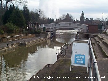
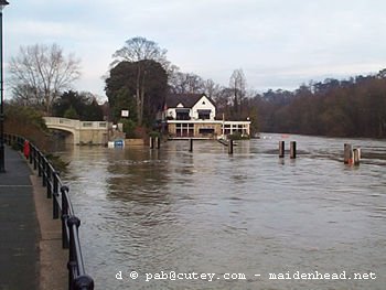
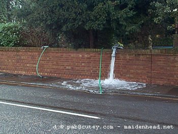
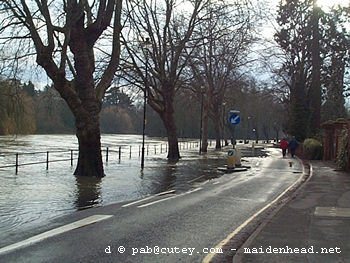
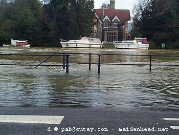
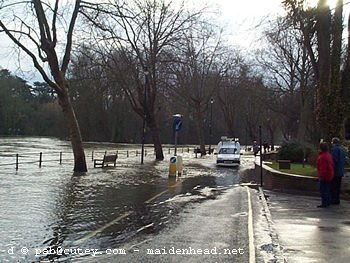
More flooding in Maidenhead The River Thames has again overflowed its banks in Maidenhead. This time it is worse than the flooding that occurred back in November. More roads are closed or difficult to pass because the river is higher. Also tributary streams are overflowing producing problems for businesses and householders not directly alongside the Thames. Ray Mill Road is closed between the bridge and Boulter's Lock. Some roads around the lock are closed. The Pound in Cookham is closed, and traffic is being diverted away from the modern road and along the old causeway road which is higher, though only single carriageway. Latest update - Tuesday 19 December at 12:15 These photographs were taken on Saturday afternoon, 16 December, unless otherwise stated. There's more photos, including Cookham, on this page.
|
||||||||||||||||
http://www.maidenhead.net/ | © Copyright | Legal notice | webmaster@maidenhead.net
This page last updated 19 December 2000